Safety Maps illustrate potential hazards and means to protect future communities from both natural and human-induced disasters.
| Fort Ord Reuse Plan | ||||||
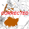
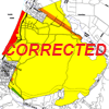 Figure 4.6-1 Seismic Hazards, Category I Corrected |
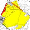 Figure 4.6-1 Seismic Hazards |
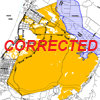 Figure 4.6-2 Fire and Flood Hazards and Evacuation Routes, Category I Corrected |
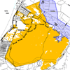 Figure 4.6-2 Fire and Flood Hazards and Evacuation Routes |
|||
|
|
||||||
| Environmental Impact Report | ||||||
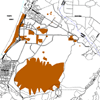 Figure 4.6-2 Hazardous and Toxic Waste Sites |
Figure 4.6-3 Seismic Hazards |
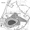 Figure 4.6-4 Expected Locations of Unexploded Ordinance at Fort Ord |
||||